Measure, describe, and structure survey points directly from your drone data. Work with drone data the same way as a surveyor in the field!
- Draw terrain points
- Points Descriptors
- Set Point Elevations
-
Point Annotations
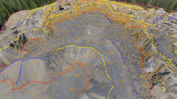
Capture linear structures and trace breaklines. Easily detect topographic details and create accurate 3D linework from your drone data.
- Draw polylines & boundaries
- Arcs
- Circle & Squares
- Extract breakpoints
- Split & merge lines
- Extract line points
- Line Offsets
- Editing & Interpolation
- Guided breakline drawing
-
Section lines
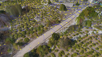
Create survey points at regular intervals. Or use intelligent algorithms to place points at bare-earth or topographic breaks. Erase tools provide an easy way to make quick edits.
- Regular point grids
- Low-pass grids
- Q-Point grids
- Remove grid points
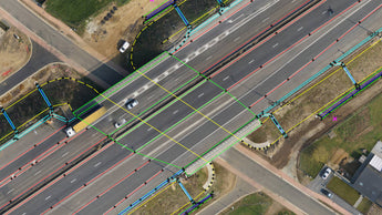
Convert your survey points and linework to a lightweight CAD model of the topography. Display the surface as triangles for design, or contour lines for map purposes.
- Quick surfaces
- Triangulate surveys
- Contour/TIN display
- Remove triangles
- Surface clipping