GeoCue TrueView 655 and 660
Call for pricing
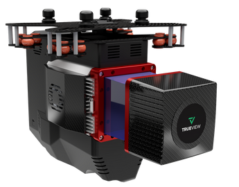
TrueView 655/660 3D Imaging System With Three Cameras
The TrueView® 655/660 is GeoCue’s third generation RIEGL integration built with the miniVUX-3UAV and triple mapping cameras (right, left, nadir) for high accuracy mapping with excellent vegetation penetration and wire detection in a lightweight payload package.
LiDAR Sensor
• Sensor: RIEGL miniVUX-3UAV
• Range: Depending on PRR. Max 330 m, and typical 170 m at
full PRR 300 kHz 20% reflectivity
• Accuracy: 15 mm and Precision 10 mm typical 1sigma
• Number of Lasers: 1
• Total Pulse Rate: 300 kHz at 120 FOV
• Rotation Speeds: 30-100 Hz
• Beam Spot Size: At 100 m :160 mm * 50 mm
• Returns: 5
Platform
• Size:
• Length: 320 mm
• Width: 185 mm
• Height: 216 mm
• Weight:
• 2.44 kg for payload
• 2.69 kg for payload with
accessories
• Power Consumption:
51.1 W typical, 63.9 W
peak
• Operating Voltage:
12 V – 34 V
• Operating Temperature:
-10° to 40° C
Applications
• Rail Inspection
• Wire Extraction - Distribution
• Road Design
System
• Control: WIFI + button control
• Storage: 128 GB internal storage + 32 GB external
Navigation Solution
• INS: Trimble Applanix APX15EI
• Post-Processing Options:
• Single Base
• PP-RTX (no base station) with fast convergence
• SmartBase
• Performance (PPK):
• 0.03 - 0.05 RMSE
• better than 0.08 deg heading, 0.025 pitch & roll
Cameras
• Type: 3 * 20 MP Sony mechanical leaf shutter, calibrated
• Motion Blur: 0.37 pixel @ 5 m/s @ 80 m
• FOV: 113º FOV configuration
Processing Modules
• LP360 Drone
(included with the following
processing modules)
• Strip Adjustment
• Photo
• 3D Accuracy
• Optional Add On’s
• Business Intelligence
• Unlimited Project
• Metashape Console
• LP360 Cloud (optional)
• Access
- Store & Share
• Starter
- Stream & View Data
- Power Search
- Automatic Ground Classificatio
