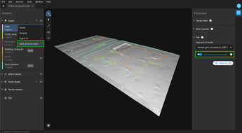
Work 50% faster when you vectorize from point clouds and verify in images, while the Smart Grid saves 1,000s of clicks creating spot elevations.
Time-saving benefit
Work 50% faster when you vectorize from point clouds and verify in images, while the Smart Grid saves 1,000s of clicks creating spot elevations.
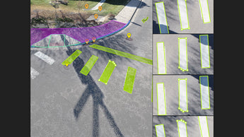
Volume measurements
Create and measure the volume of any object, even against a wall or in a corner, with fast, simple steps.