Chat with us, powered by LiveChat

GeoCue LP360


Call for pricing

3D High Performance
Point Cloud Processing

Airborne LIDAR or drone collected imagery, 3D point clouds have become a critical element in mapping. LP360, an advanced desktop software, makes easy work of extracting information and deriving products from point clouds in standalone or ArcGIS environment.

Point Cloud Visualization

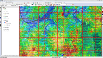
Comprehensive visualization is a core element of analyzing point clouds. LP360 gives the ability to not only see your world in 3D but to answer questions previously requiring field acquisition techniques.

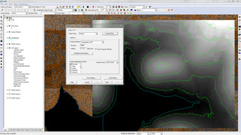
 Points can be displayed by intensity, color value, elevation and classification. Rendering modes include points, a surface model triangulated irregular network (TIN), wireframe and combinations of points on surfaces. Surface “sun” shading is also supported. Contours are dynamically generated and displayed. Viewing windows include plan (map) view, profile (cross section) and 3D.

 Use the many display combinations in LP360 to save time and money by getting your questions answered from the office.

Seamlessly Manage Thousands of Files

Due to the size of these extremely powerful data many GIS professionals are unable to gain the maximum advantage from them. LP360’s advanced display techniques have solved this barrier. Overcoming this obstacle is just one of the ways LP360 brings the benefits of LIDAR to the GIS desktop.