GeoCue TrueView 515
Call for pricing
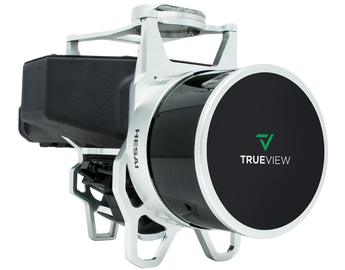
TrueView 515
GeoCue’s TrueView 515 is simply the best performing LiDAR/camera
system in the mid price range. The system has been upgraded with two new
oblique 26 MP cameras. This compact 3D imaging system has impeccable
definition along wires, superior ground cover beneath vegetation and
sensitivity like we’ve never seen in this class system.
System
• Control: WIFI + button control
• Storage: 128 GB internal storage + 32 GB external
Processing Modules
• LP360 Drone
(included with the following
processing modules)
• Strip Adjustment
• Photo
• Optional Add On’s
• Business Intelligence
• Unlimited Project
• Metashape Console
Navigation Solution
• INS: Trimble Applanix APX15EI
• Post-Processing Options:
• Single Base
• PP-RTX (no base station) with fast convergence
• SmartBase
• Performance (PPK):
• 0.03-0.05 RMSE
• Better than 0.08º heading, 0.025 pitch & roll
Cameras
• Type: 2 * 26 MP Sony mechanical leaf shutter, calibrated
• Motion Blur: 0.27 pixel @ 5 m/s @ 80 m
• FOV: 113º FOV configuration
LiDAR Sensor
• Sensor: HESAI XT32
• 905 nm Class 1 eye safe
• Range: Max 120 m, typical 80 m a 20%
• Accuracy: +-1 cm and precision 0.5 cm typical 1 sigma
• Number of Lasers: 32 channels spread over 31º (-16, +15)
• Total Pulse Rate: 640,000 pts per second for single return, up to
1280,000 points/sec 2 returns
• Rotation Speeds: 5-20 Hz
• Beam Spot Size:
• In deg: 0.087 * 0.131
• At 80 m: 12 cm by 18 cm
• Returns: 2
Applications
• Densely Vegetated Topography
• Coal Pile Inventory
Platform
• Size:
• Length: 313 mm
• Width: 156 mm
• Height: 212 mm
• Weight:
• 1.99 kg for payload only
• 2.47 kg for payload with
batteries & accessories
• Power Consumption:
38 W
• Operating Voltage:
12–34 V
• Operating Temperature:
-15 C–50 C
Applications
• Densely Vegetated Topography
• Coal Pile Inventory
Platform
• Vertical Structure
