GeoCue 680/680LR
Call for pricing
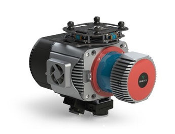
Meet GeoCue TrueView 680/680LR Sensor, with Three Cameras for Better Range and Point Density
The TrueView 680/680LR is GeoCue’s best 360 degree field of view system, built with the Riegl VUX-1UAV and the 680LR integrates a Riegl VUX-1LR. Select the system that best suits your projects and trust that you will achieve incredible performance in terms of accuracy and point density.
All 600-series payloads, are NDAA-compliant and can be upgraded to accommodate dual purpose drone and mobile mapping.
LiDAR Sensor
• Sensor: RIEGL VUX-1UAV
• 1550 nm Class 1 eye safe
• Range: Max 1400m, and typical 160m at FULL PRR 1200kHz
20% reflectivity.
• Accuracy: 10mm and Precision 5mm typical 1sigma
• Number of Lasers: 1
• Total Pulse Rate: 1200kHz, with up to 1,200,000 measurements
per second
• Rotation Speeds: 10-200Hz
• Beam Spot Size:
• At 100m: 50mm
• Returns: 7 at 1200kHz, up to 15 at lower PRR/Higher range
Platform
• Size:
• Length: 310 mm
• Width: 238 mm
• Height: 180 mm
• Weight:
• 4.97 kg for payload
• 5.22 kg for payload with
accessories
• Power Consumption:
93W typical,
105W peak
• Operating Voltage:
12-34V
• Operating Temperature:
-10° to -40° C
Applications
• Densely Vegetated Topography
• Stock Pile Volumetric Calculation
• Vertical Structures
• Wire Extraction - Distribution
• Vegetation Encroachment
System
• Control: WIFI + button control
• Storage:
• 128 internal storage + 32GB external storage for
Trajectory and pictures
• 2TB internal storage for Laser Data, 64GB USB
External
Navigation Solution
• INS: Trimble Applanix APX20
• Post-Processing Options:
• Single Base
• PP-RTX (no base station) with fast convergence
• SmartBase
• Performance (PPK):
• 0.03-0.05 RMSE
• Better than 0.08° heading, 0.025 Pitch & Roll
Cameras
• Type: 3 * 20 MP Sony mechanical leaf shutter, calibrated
• Motion Blur: 0.37 pixel @5 m/s @ 80 m
• FOV: 113° FOV configuration
Processing Modules
• LP360 Drone
(included modules)
• Strip Adjustment
• Photo
• 3D Accuracy
• Optional Add On’s
• Business Intelligence
• Unlimited Project
• Metashape Console
LP360 Cloud (optional)
• Access
- Store & Share
• Starter
- Stream & View Data
- Power Search
- Automatic Ground Classification
